Public Safety Building Survivable Design: Part 1: Risk Assessment and Security
The functional requirements of Public Safety Buildings require special attention to survivable needs that include the building programming, building design, site selection and site design, and building system selection and design. The “Essential Facility” building type requires a systematic, analytical approach to review and determine code mandated requirements, guideline requirements and allow flexibility for grant requirements that must be met to ensure funding continuity, and specific client requirements. The analysis quite often reveals a complex web of criteria that sometimes will be at odds with each other. More importantly, the established design criteria can have severe budget impacts. It should be noted this is a “brief” introduction to a very complex subject; specific project criteria, client needs, and specific publications reference herein should be the final resource for any project analysis.
Risk Assessment
Risk assessment should consider far reaching regional threats, local natural and man-made threats, building typology and perceived threats to the ongoing operation of the specific program, and site related threats. Typical standards utilized for Risk Assessment are published by FEMA, the Department of Defense, and the GSA. For the most part, the Department of Defense UFC-4 Standard is used as a reference for the various other agencies mentioned unless it is a Department of Defense Building (DoD). FEMA 361 Design and Construction of Community Shelters, FEMA 426 – Reference Manual – to Mitigate Potential Terrorist Attacks Against Buildings, and FEMA 452 – How to Guide To Mitigate Potential Terrorist Threats all refer to Department of Defense UFC-4 in regards to site security and stand-off zones. It should be noted these are guidelines and unless the project is an actual Department of Defense Building with DoD officials the UFC-4 standard is not strictly applied. The application is based on the project’s perceived and analyzed risks. The site and project review process should begin with:
- Vulnerability analysis that identifies the value of assets and the types and severity of threats
- Risk Assessment that assigns a value to all of the above so they can be prioritized
- Development of Mitigation Options that consider overall cost and benefit to the various solutions
- Final Decision on the best Risk Management Strategy
Security Standoff Zones, Site Access Control, Definition of Public Access and Secured Access Zones
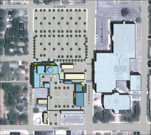
Regarding the Public Safety Building site design layout, it is important to define site stand-off zones, site access control, and the definition of secure and public access zones from the building per the UFC-4 guidelines. This equates to an 82’-148’ standoff zone for a controlled perimeter, public drives, and public parking; and 33’- 82’ for roadways and staff drives within the controlled perimeter. These standoff zones are a good starting point and can be lessened if the property limits and perceived threat do not allow full compliance. The areas surrounding the building should be free and clear of visual obstructions that hinder the natural surveillance of the site. Further, site access should be monitored at the controlled perimeter via security gates and access control (Closed Circuit TV, card readers, scanners, etc).
The survivability of the Public Safety Building is also extended to the surrounded site conditions and buildings. Because this building is an emergency response facility it must remain operational before, during, and after manmade and natural events. For this reason, it is ideal to:
- Design other surrounding buildings such that they will not produce flying debris hazards and design them for Coastal Wind Speeds or other Wind Borne Debris Region Standards
- Maintain the grounds and trees making property free of potential flying debris
- Site fencing, light poles, and other site amenities should be designed to withstand appropriate wind speeds
- Ideally all power and utilities should be constructed underground in protected duct banks
- Surrounding roads should be above flood hazard facility to maintain continuous ingress/egress, and many other considerations
- Design the surrounding landscape to follow CPTED principles (Crime Prevention Through Environmental Design)
- Flood Hazards should also consider the following:
- Use FEMA/FIRM maps or other jurisdictional maps such as SLOSH maps to review and determine threat
- Locate Site Outside of Coastal (high hazard areas), Seaward, and areas with potential moderate wave action, as well as outside of known floodways
- Location of lowest floor
- 2′ above B.F.E. of 100′ year event or
- Still water flood elevation at 500 year event or
- Lowest elevation required by community flood plain or
- 2′ above highest recorded flood elevation
- If in coastal storm source
- Maximum still water at Category 5 Hurricane
- Wave of one story elevation at 12% chance of being equated
Next week: Public Safety Building Survivable Design: Part 2: Essential Facility Design

